Updates ·
The map of Orrin, one hundred years after the Sundering
Two shores, forty zones, and the Rift between them. The whole continent as it stands today.
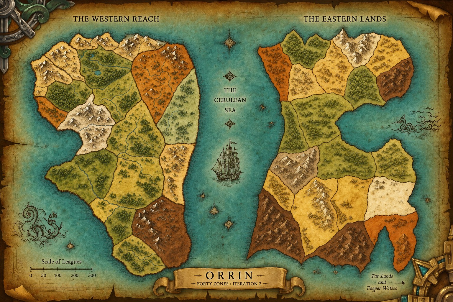
Orrin was one continent. A hundred years ago it split along its whole length, the sea rushed in, and the empire fell into it: its capital, its archives, its ruling houses and every record of the cause.
What is left is two shores across a strait of black water called the Rift. On the west, the Accord: a senate, licensed magic, an organised church. On the east, the Kindred: sunclans, sworn bands and the creed that the land decides. Each has spent a century blaming the other.
Forty zones, with the level ranges we are building them for. Elderwood, on the Accord side, is the first.